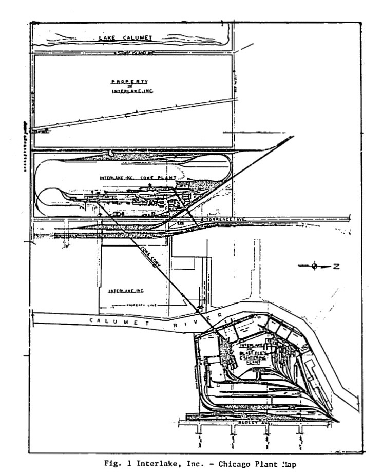
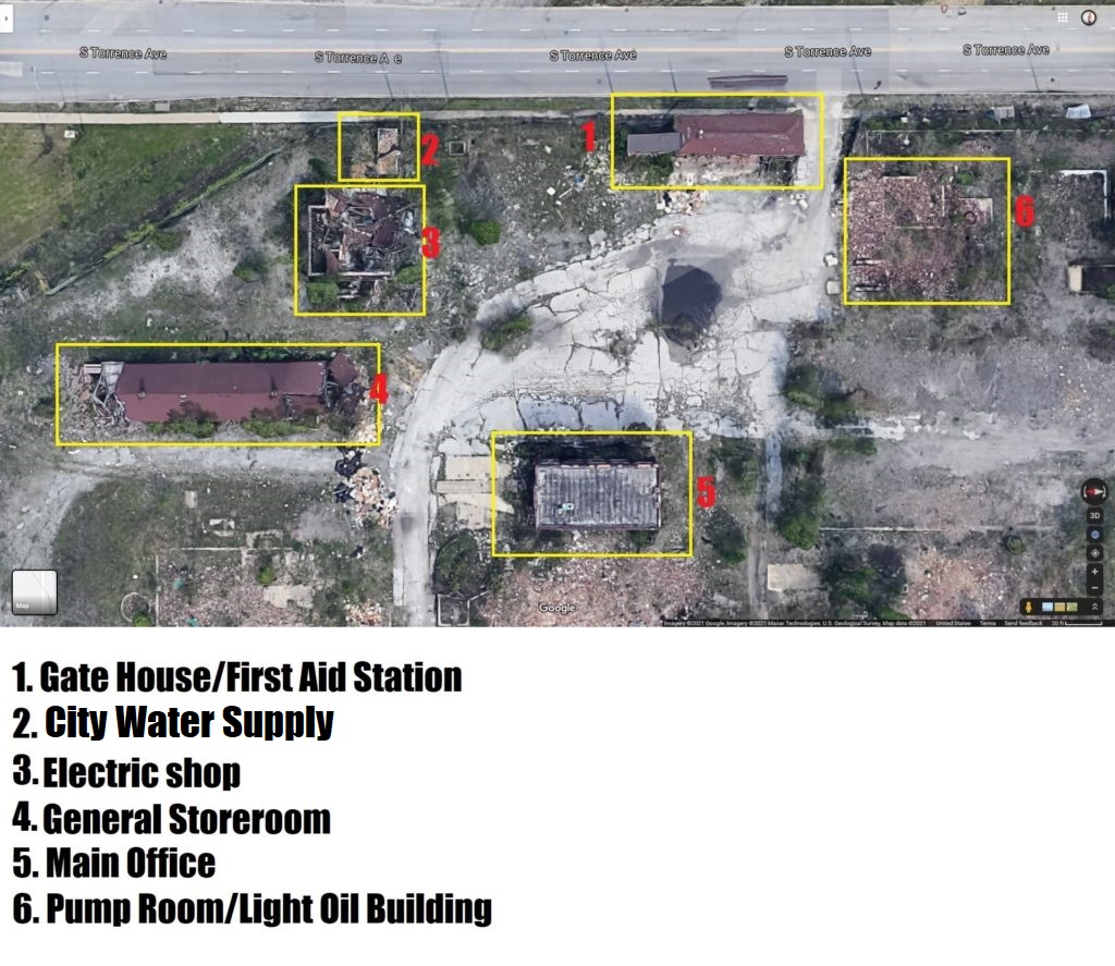
I have used Google Maps satellite view as a tool for exploring the property since before my first serious visit. This overhead view reveals details of every structure including the remains of other since fallen or destroyed. More than once, I have been unable to see or understand a structure even when I was nearly upon it or very close. If I could fly with a hawk hundreds of feet above the property, it would have always been clear. The map featured above was taken from a very interesting EPA document I found today and added to the Resources page. The first real map I ever had with actual explanations was from my friend Doug, who was the manager of the ovens department for many years and spent most of a career with Interlake/Acme. He drew me the following map with explanations (he provided a legend separately).
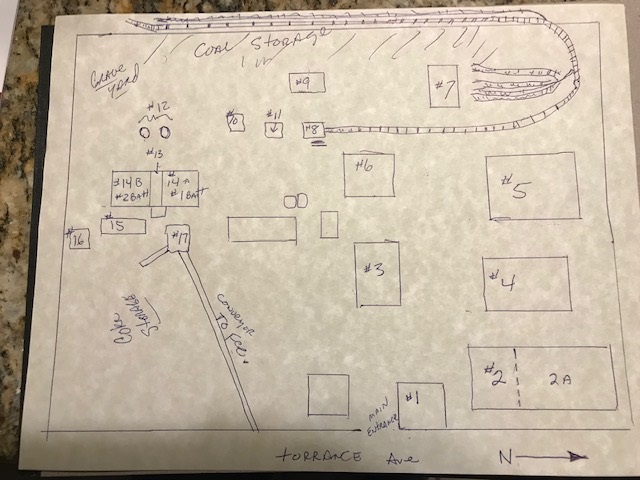
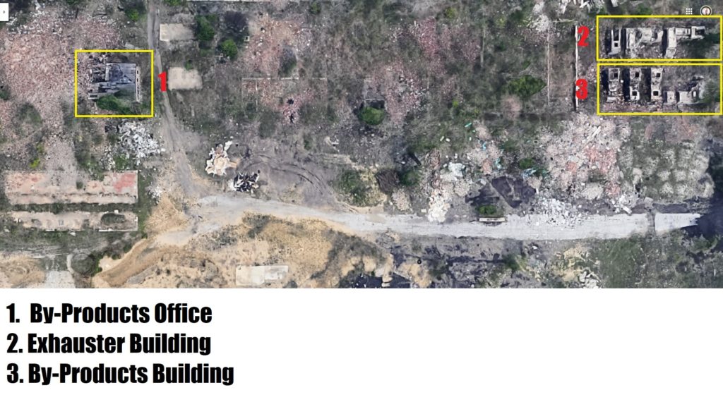
It does not cover anything in the by-product plant but it does identify the main structures, most of which are still intact. (He did later send me a clarification regarding ‘2’ and ‘2A’: “I noticed that on the drawing of the layout I mistakenly labeled the electric shop and the storeroom as one building (the building that was the electric shop was originally the plant “cafeteria” way back when). So referencing the overhead photo of the plant as it is now, the correction is– the building to the north of the gatehouse is the electric shop and the first building west of that was the storeroom.”)
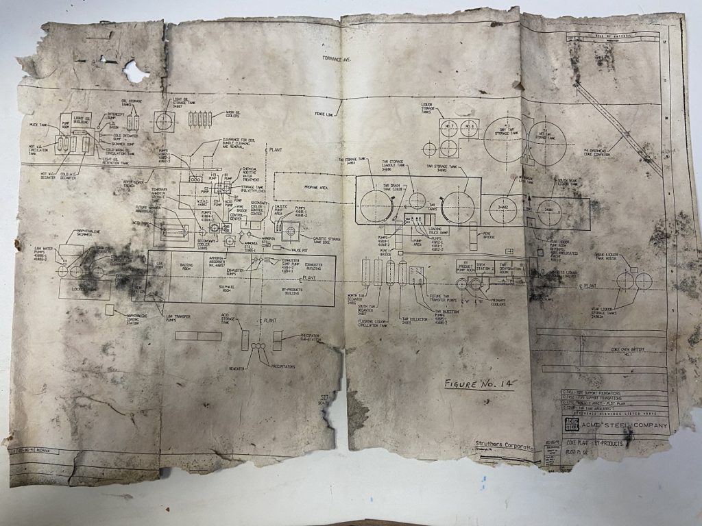
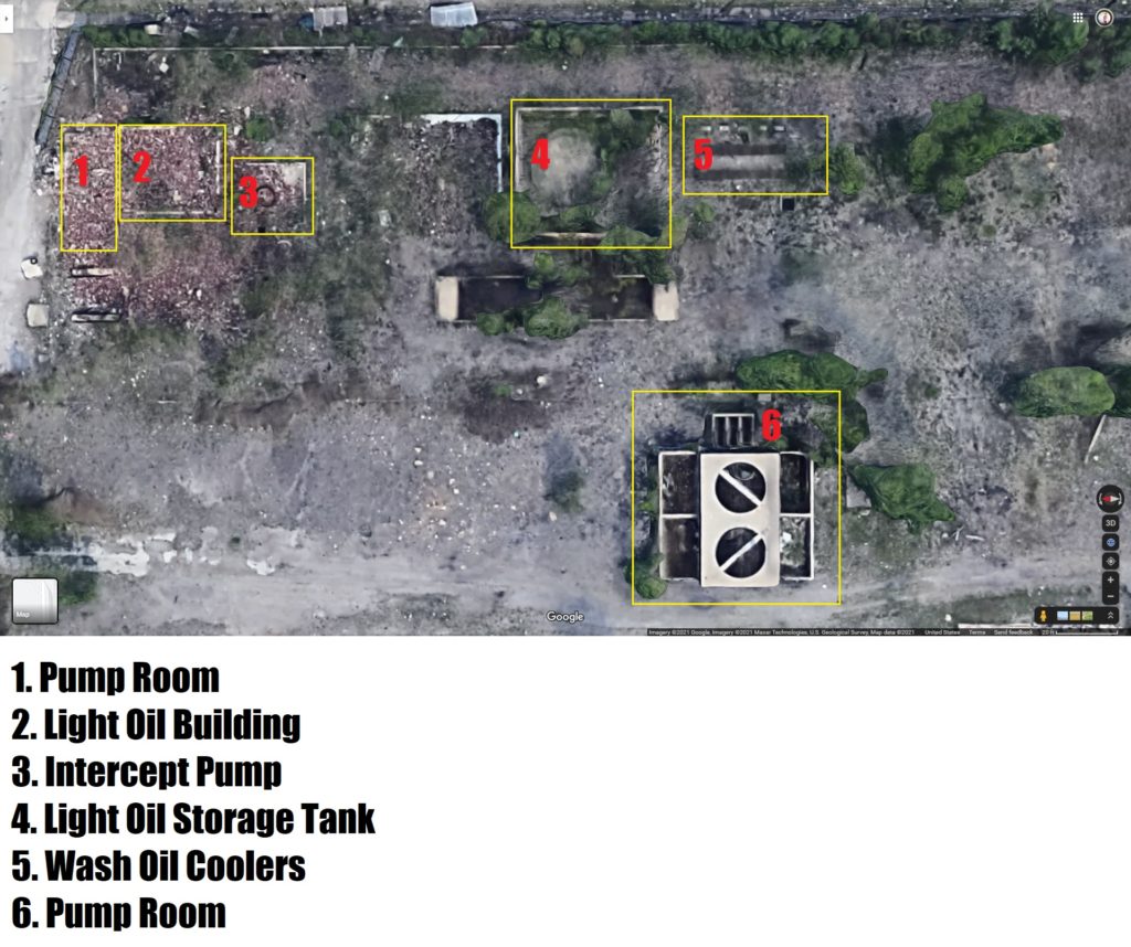
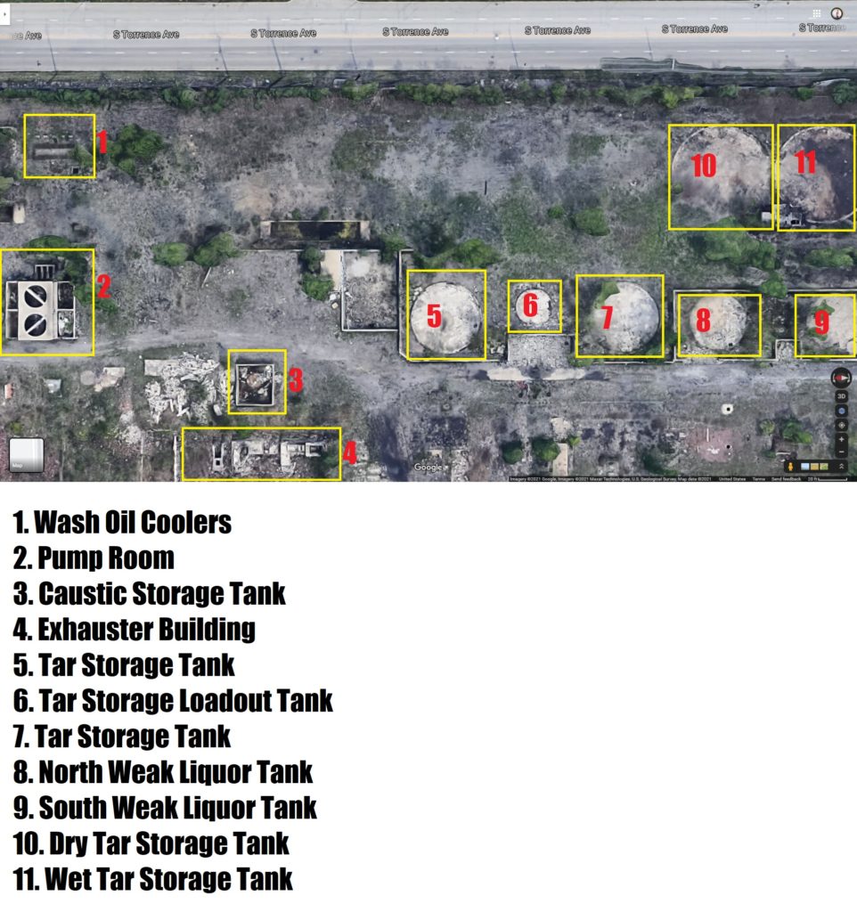
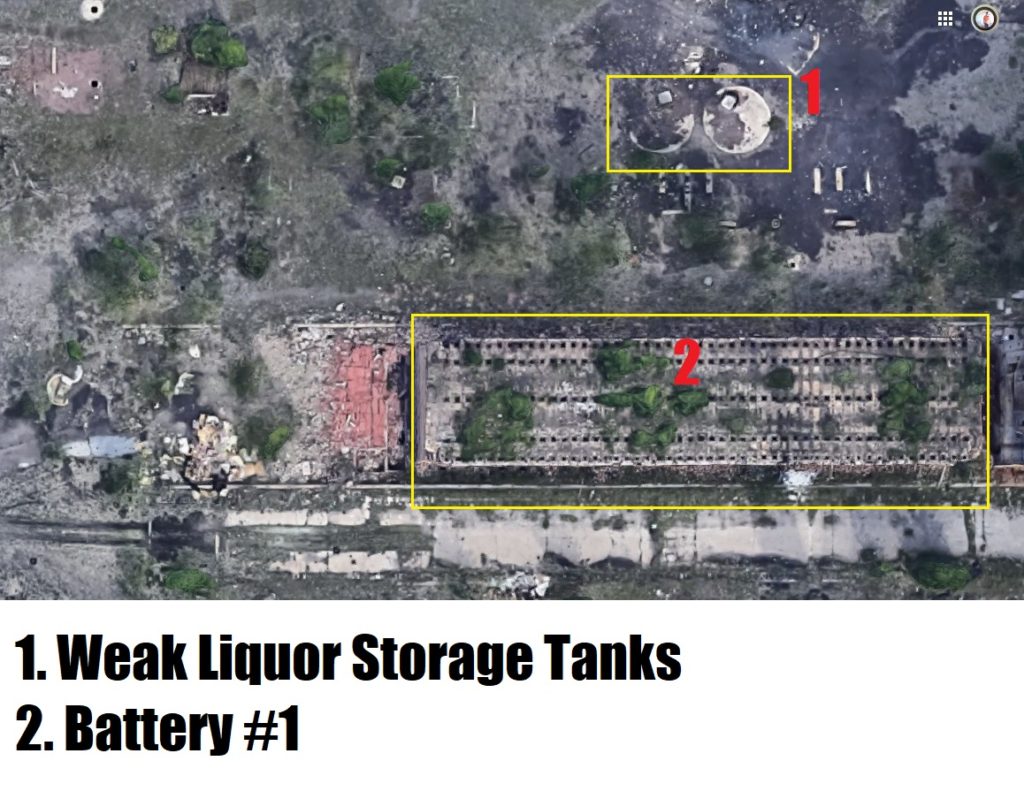
Another very useful tool was the map of the by-product plant which I found a few weeks ago. It is the opposite of Doug’s map, as it labels almost zero non-BP structures.
Today I sat down and took full screen HD screenshots of every portion of the property, all the way south to 116th Street. Then I used Doug’s map and the BP map to try to label the individual structures. There were a few issues preventing me from completing my work entirely:
- The BP map does not label anything south or east of battery #1, yet there are structures
- Doug’s map is excellent but (by his own admission) not to scale
- Some of the structures on the BP map are unlabeled
- At least one structure on the BP map is labeled incorrectly: the old power house is labeled as ‘locker room’. The real locker room (coal handling office) is further north and outside the scope of this map.
Despite these obstacles, I did my best and I do feel this is still an interesting resource, unavailable elsewhere. As time goes by and the plant degrades further, enveloped by entropy, Google’s satellite view will as well. I am glad I have this snapshot, today, to share before things continue the way they are going.
Some of my screenshots contain no structures, or structures that I cannot identify using the resources at hand. As such, I have not included them. Hopefully in the future I will be able to add more maps as I render them.

2 replies on “Maps”
Hi there! I took a bunch of photos myself a few summers ago. I’m planning on showcasing via an online gallery. I stumbled on your page and I love the history you’ve captured. Would it be ok to use your blog as a source? I will of course cite you, and wondering if there’s any way people can support your work? Do you have a donations option that I can share?
Karen- thanks for the comment! I sent you an email. I’d love to chat. Thank you very much!