Surveyors have a language all of their own. Once upon a time, people needed a way to express via the written word where a piece of land was, and how large it was. I don’t know if surveyors still write like this or not. Then again, at least in South Deering, nothing has changed in over 100 year so nothing needs to be written at all!
As I continue to dig through documents stashed away with the county clerk, I came across clearly stated descriptions of the two parcels which make up what we know as the coke plant.
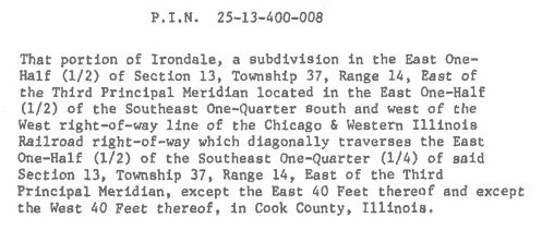
This is especially difficult to describe as the northern border is actually northwestern. But once I struck upon this info – particularly the section/township/range, I just kept on digging.
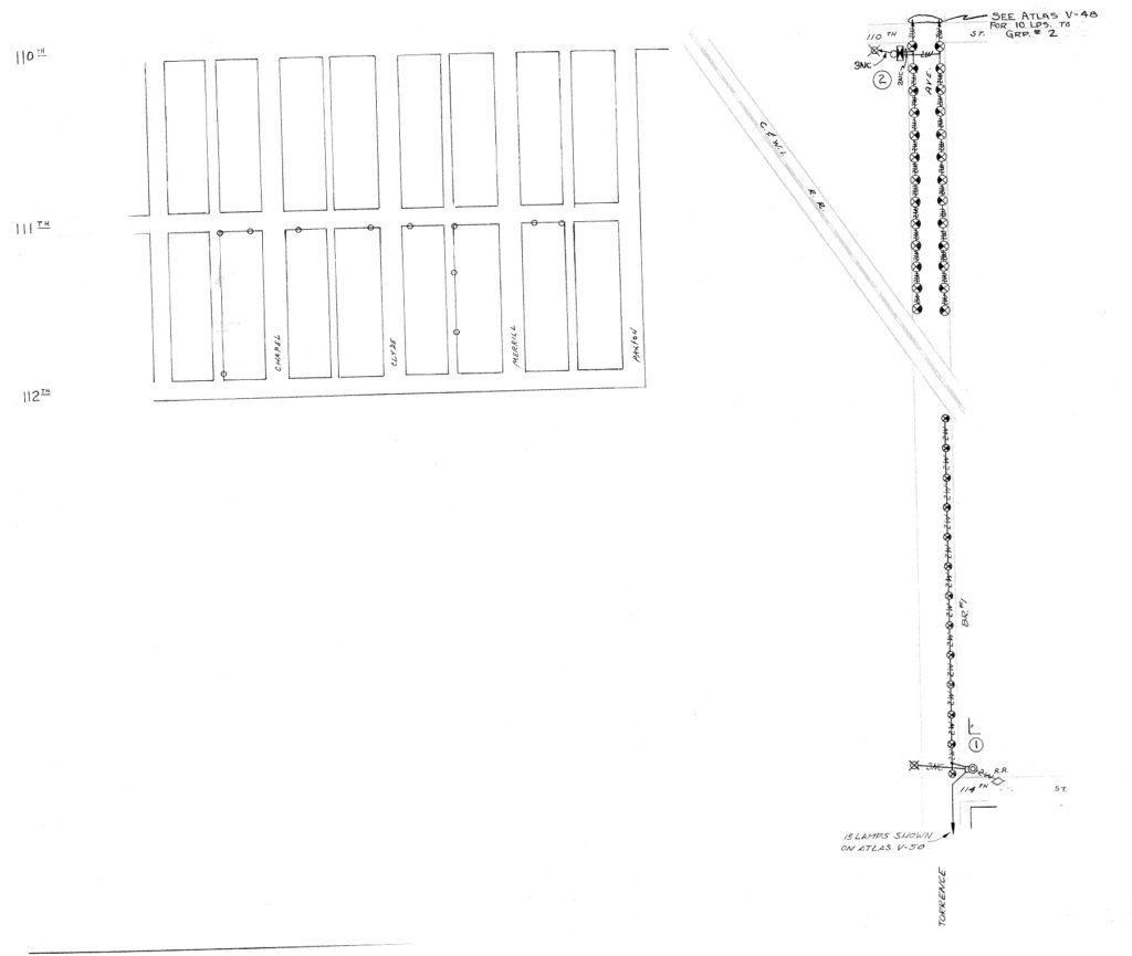
I was at first confused by the 80 acre map. As all the streets normally seen further north in Trumbull Park are shown here as extended all the way south of 110th Street, I thought maybe this was just something surveyors did for simplicity sake. I thought that they showed the streets as they WOULD continue – if they did. But Calhoun Ave. does not run at a SE angle anywhere! And wait a minute…what the hell is Louisville Court?? That is when I realized that this undated map has to be from pre-1800. The coke plant was already hard at work by 1902, assuming a year or two to construct it, this had to be drawn in the late 1800s at best. The comments in the right side margin make references to 20th century dates but I believe those were added later, with the original map used.
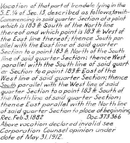
Note the references to the Village of Hyde Park – this was annexed by Chicago in 1889. The references to ‘vacation’ I believe are referring to ‘vacating’ – as in leaving the area as the streets and structures are permanently removed. Also seems as though the New York, Chicago and St. Louis RR (which is still active, albeit owned by a different railroad, and still the western border of the coke plant) was shared by Yates Ave, with two way traffic on on each side of the tracks.
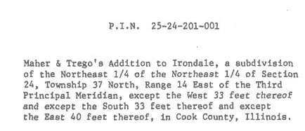
A Google search of “Maher & Trego” produces no useful results. Were they early settlers who ‘owned’ this area of Irondale? Real estate developers? Sounds like 115th St was vacated in 1920.